Lycian Way, Turkey. Olympos to Tekirova.
Day 1
Hobo Sandy greets us with tail wagging beside the junction of creek and Mediterranean in the early morning. He appears to have slept on the same spot in the sand where we last saw him yesterday.
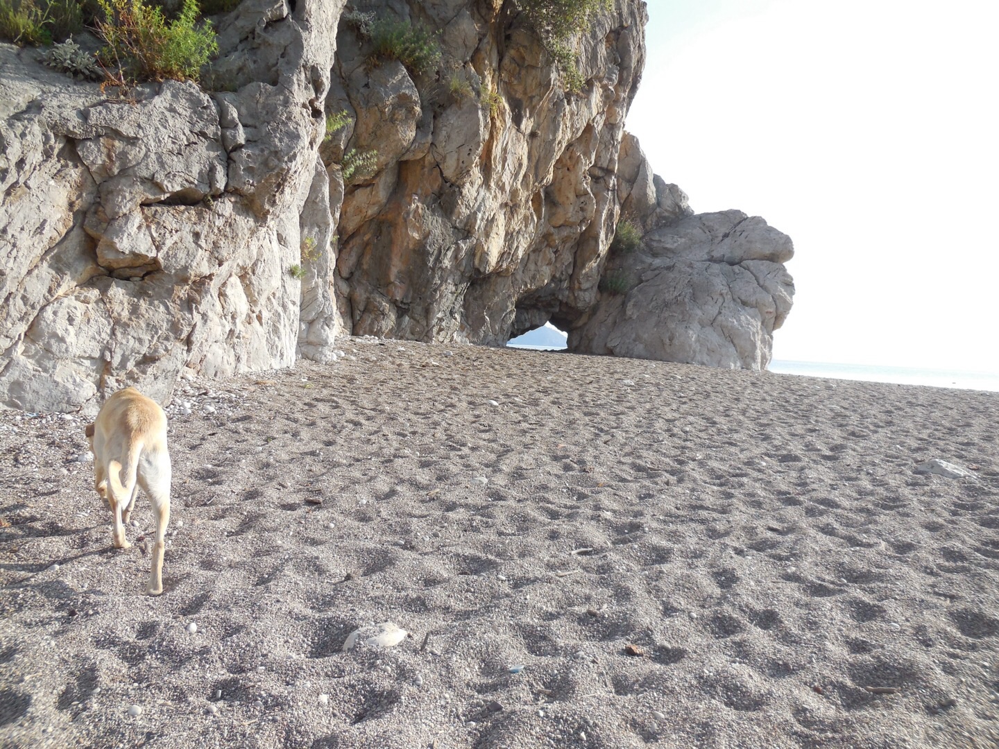
Having woken early in preparation for the long walk to Tekirova we are almost alone on the long beach as we crunch our way along the shifting pebbles that are almost as difficult as soft sand to cross.
Our heavy packs collude with shifting pebbles underfoot to have me sweating in the early morning despite the cool air.

Beyond the first beach hotel that marks the commencement of Cirali we leave the beach to walk along the bitumen road taking us towards the hills to come.
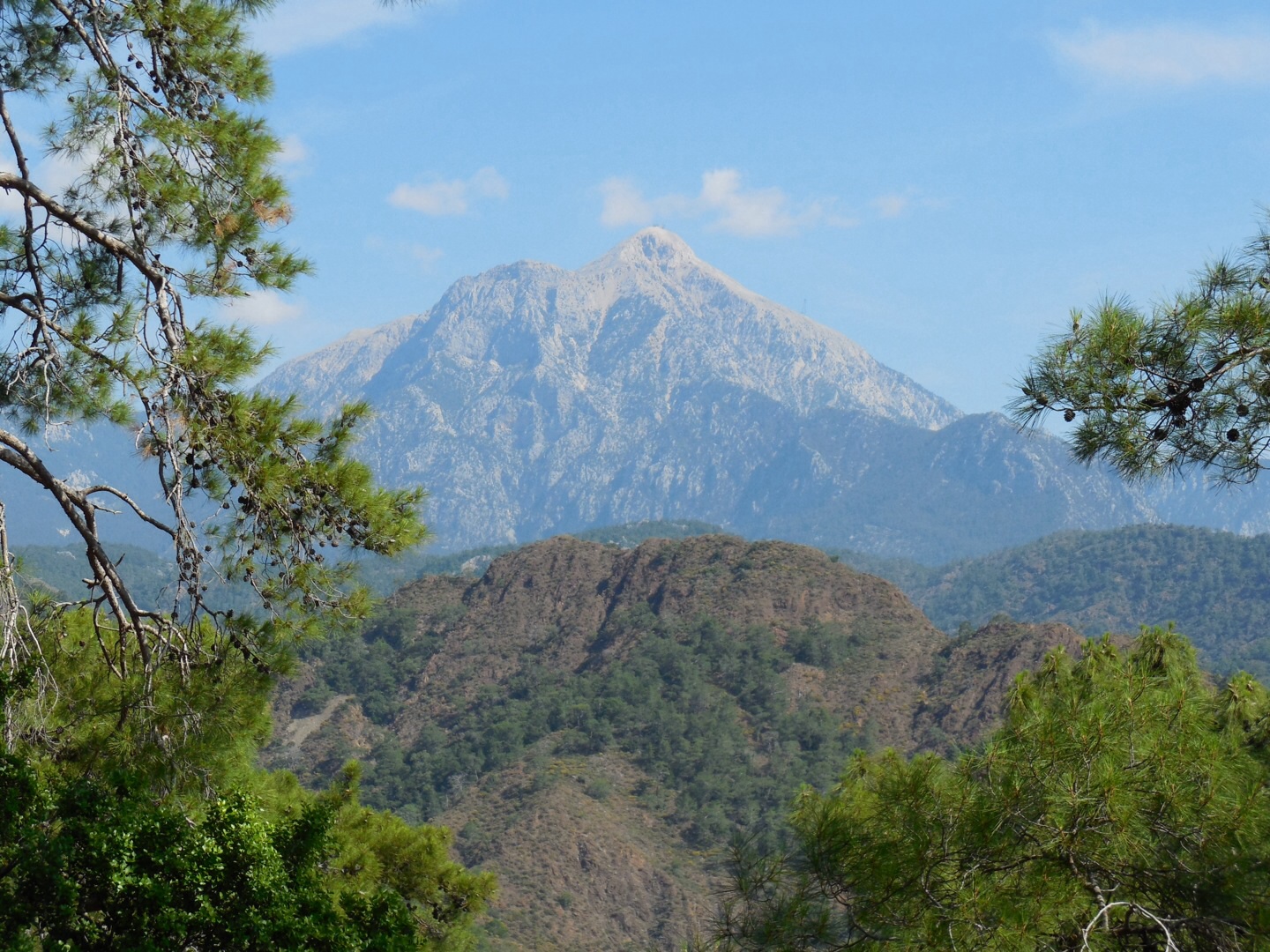
Two distinct options for the Lycian Way divert from Cirali. Inland the trail climbs the mighty 2366m peak of Tahtali D or alternatively a coastal route winds around the bays to Tekirova and the ruins of Phaselis before heading inland to rejoin the mountain route near the town Dedelme.


Having just finished the mountain route between Demre and Fineke and knowing that the final two days of the Lycian Way will be spent climbing 1500m over Hudaci Ridge we have elected to follow the coastal route.
Our guidebook’s opening description ‘This mainly easy, long route’ fills us with trepidation. Very little turns out as written in this guide.
Reaching the end of the flat bitumen road that traverses the length of Cirali the customary green and gold distance signs state 19km to go after the 4km we have already walked contrast with the 14km distance listed in the guide.
Everything is as it should be.
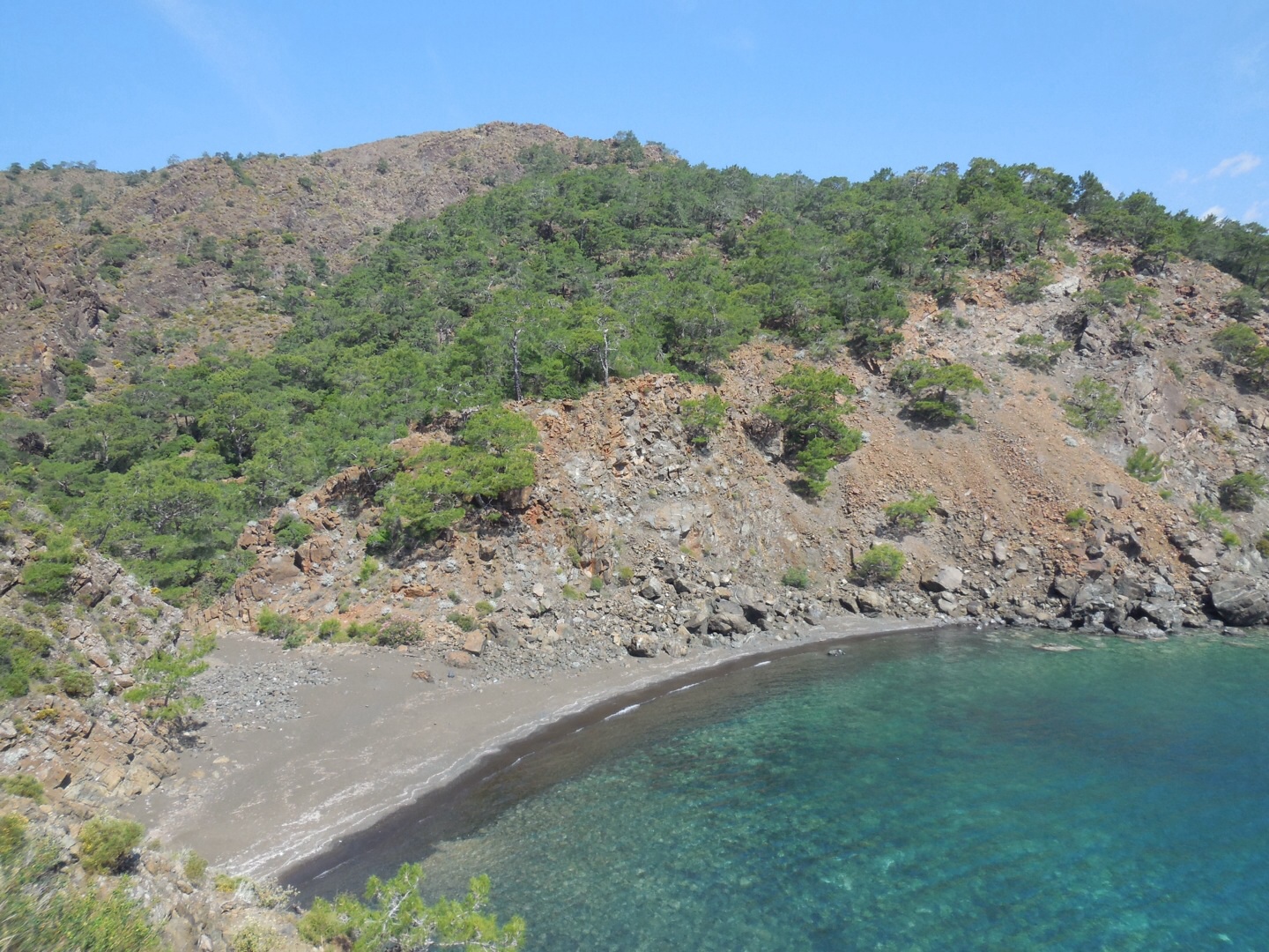
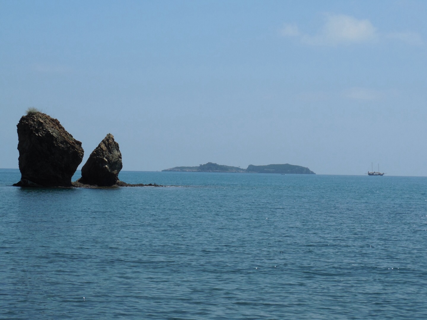
A steep rocky climb takes us up and around the headland before winding back down and around the rocky cove that follows.

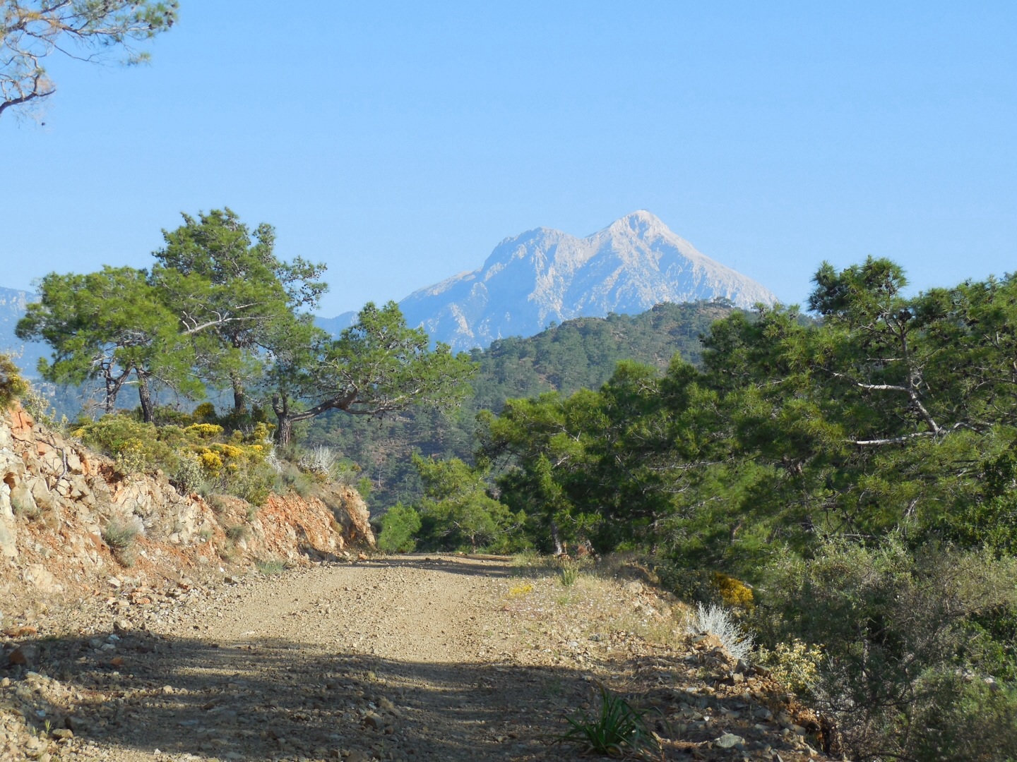
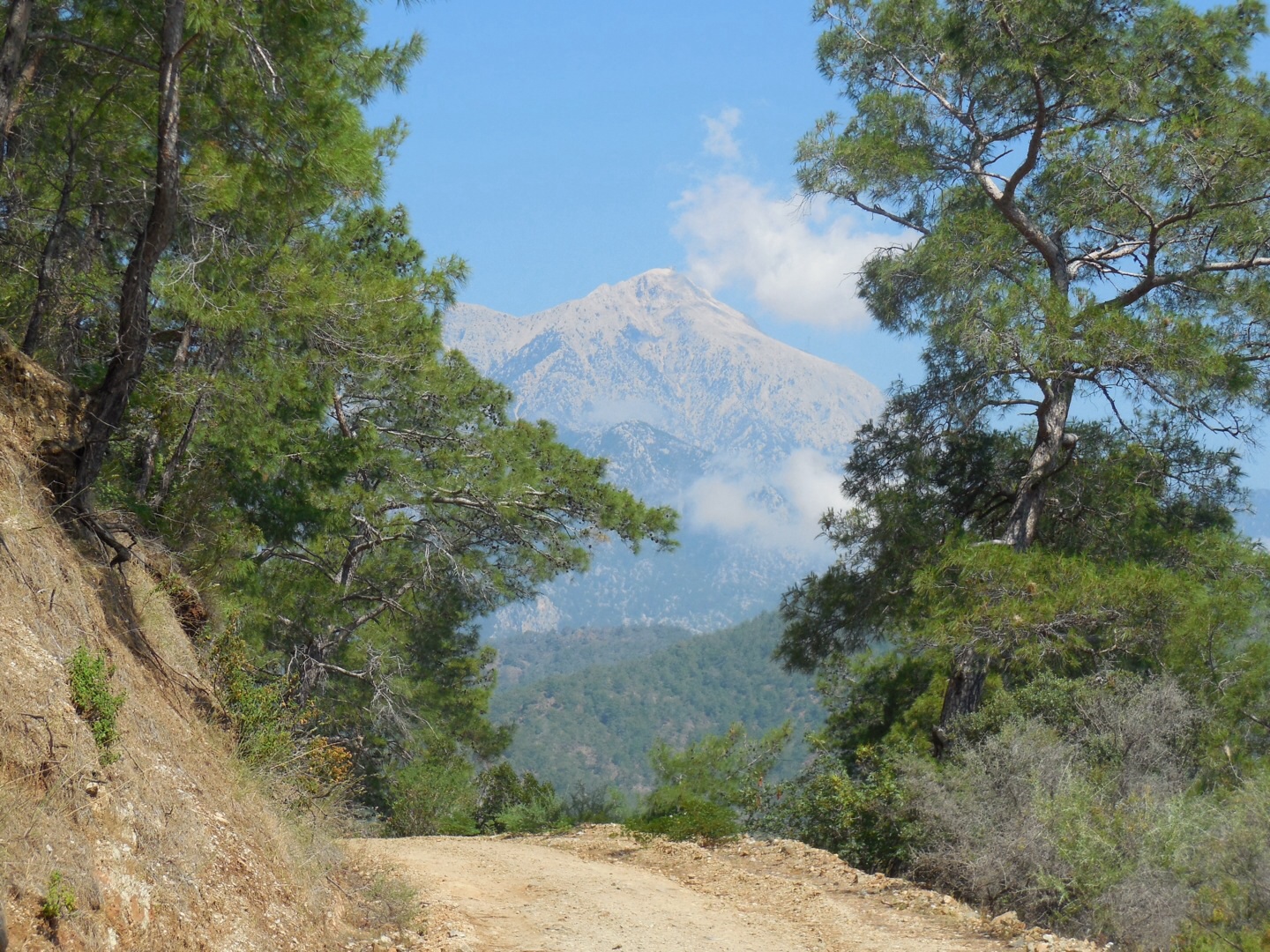
Clear air and blue skies allow great views of the lofty Tahtali D dominating the inland horizon each time the trail turns back as we climb another steep headland ridge.
All slopes we encounter pale in comparison to the towering inland skyline still the roughness of the terrain we traverse makes our progress hot and slow.
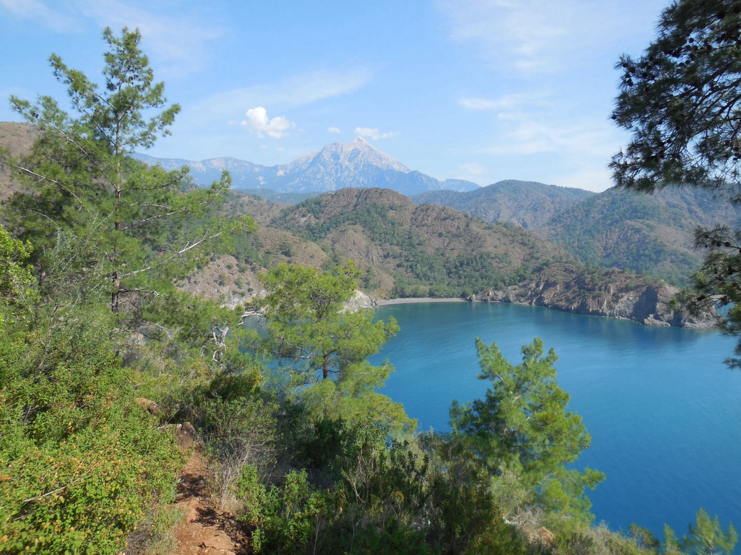
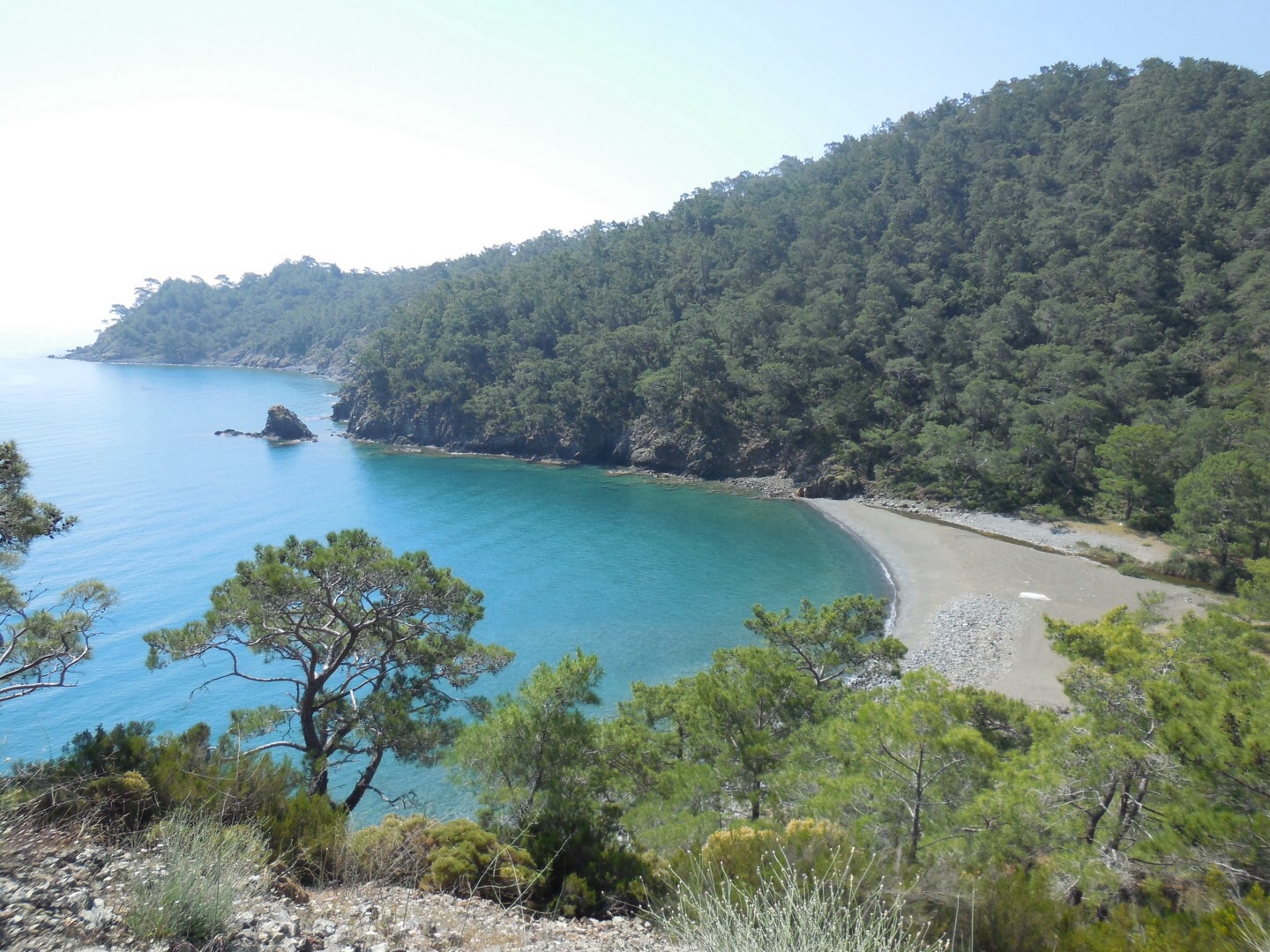
A short grey beach at the base of our second descent tempts us both from above with clear blue waters however as we come closer a boat cruises around the headland which drives thoughts of swimming from our minds.
An unusual hardhat wearing cairn of stones leads us up the apparently dry watercourse from the beach before we turn right and begin to climb the very steep red rock ridge to the right.

This section is so steep we need to pause for rest halfway up and as we rest I can hear water running in the valley below despite having crossed no flows into the Mediterranean.
I consider searching out the flowing water to refill water bottles however the thought of climbing down and up again rapidly dissuades me.


Our sweaty climb recommences and the following descent eventually has us climbing down onto another longer grey pebble beach where the boat that passed us earlier has anchored.
A couple of Turkish women have come ashore and seem to be collecting driftwood from the bushes as we crunch along the beach towards a dry rocky watercourse at the far end.


Elevation charts in our guide are often misleading as an average elevation of terrain passed always seems to be indicated rather than a more precise series of squiggles that might actually assist with identifying our location.
Having lost sight of markers once more we sit on rocks in the shade doing our best to try and get a sense of where we are and how far we have to go from a combination of the map and the vague guide descriptions.
Hearing some people approaching who we assume will be hikers coming the other way we are very surprised when they actually turn out to be Lycian volunteers who are painting fresh markers on the route.

We chat with them for a while and thank them sincerely for their generous effort after they reward us with information about the route ahead. They tell us that there is a new route being created for the section soon to come as a result of a recently constructed road and warn us not to turn left and follow fresh markers that eventually lead out into the hills and go nowhere but to follow the ‘old route’.
Another high steep ridge that is swallowed in the average elevation of the flat ten meters indicated in our guide follows and just beyond the crest we encounter another couple of Lycian volunteers who are trimming back scrub and thorns from the path.

Finally at the base of this last ridge we encounter a beach that matches up with descriptions in our guide, we have only reached the beginning of the second paragraph describing this long haul.
Resting in the shade of a tree in an area obviously favoured by many camping hikers before us, we consult the guide and map once more in an effort to avoid ending up on the trail to nowhere we have been warned about by the volunteers.
As we do so we realise that we have made the fatal flaw of not asking for a clear description of where the new trail veers from the old for both the old description and the map indicate we turn left and head inland from the point where we are.
More confused than ever we decide to split up and try to relocate some markers. Pam heads along the pebble beach while I follow the gravel tracks inland.
After we rejoin Pam reports she has found no markers while I have seen a few so we decide to follow the gravel road for a while before reassessing.
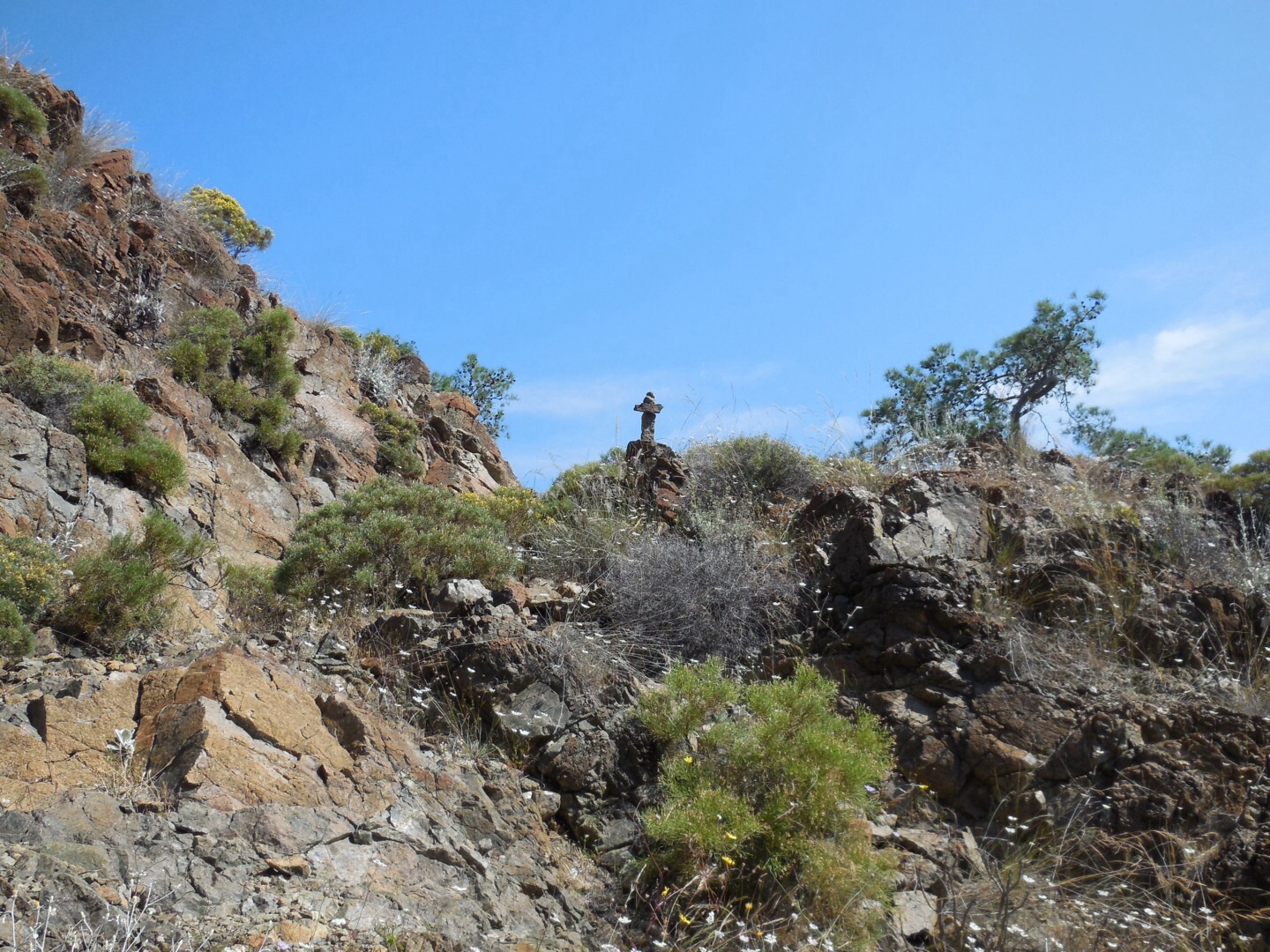
After crossing a broad dry gravel stream bed we come to a T-intersection where a cross clearly indicates not continuing straight on while markers indicate that we should turn left and head further inland.
Both us us agree that this must be the left turn we have been advised not to follow however by now we are both quite averse to following paths so clearly indicated as being incorrect by big red crosses.
After deciding we will continue straight ahead in a search for makers indicating the older trail we walk for ten minutes or so further along the gravel road that obviously has had no foot or vehicular traffic since the rains of a few days ago without finding a single marker or stone cairn.
The map from the guide book indicates a short inland turn however also advises that we climb the ridge to come heading towards the water. Perhaps there will be a branch heading right from the gravel road beyond the left turn so clearly marked.
There is no harder step taken than the step reclaiming distance already walked and we are feeling tired and disgruntled by the time we return to the red cross and turn inland again.
Several crossings of the wide soft gravel watercourse follow under the blazing sun and blue sky before we take a rest sitting on the bulldozed earth to the side of the road.
A dual cab ute passes us on its way to the beach and soon returns leaving us coughing in the dust cloud raised.
Pam decides that we are obviously heading in the wrong direction which has the counterproductive effect of making me sure we must be heading in the correct direction.
We decide to split up again and go unladen in search of markers as neither of us has seen one for several hundred meters.
I wait until I have passed another four markers before returning. Pam accuses me of being un-Australian as I have not responded to the Cooeee she has called out in search.
The crunching of deep gravel underfoot must have drowned out the sound for in all honesty I never heard a thing.
Pam still has not found any alternative marked options to the one we currently follow so we continue winding along the gravel road before crossing a shallow stream flowing directly across our path via stepping stones.
A few corners up the road from the stream we come across the campsite of the volunteers and a few corners on from there the markers leave the road and turn right heading up a steep slope.

The trail the markers follow has obviously had very few people walk along it for other than the red and white markers there is no discernible sign of regular foot traffic.
We have run out of options.
Obviously following a trail that leads nowhere and that will leave us in the middle of rough unfamiliar terrain is not a great idea however by now it is getting towards mid-afternoon. We have wasted a lot of time frigging around trying to find the trail and are out of patience and momentum.
Finally in desperation I refer to the mapswithme app that we have not used since my long uphill incorrect lead between Kalkan and Bezirgan. This app lists paths that have been GPS plotted by other travelers via OpenStreetMap.
The uphill trail we have just passed is not shown at all so has obviously never been GPS plotted or submitted to OpenStreetMap by anyone else however the app shows the road we are on leads back to the beach before heading to a clear squiggling trail that roughly follows the Lycian Way indicated on our map all the way to Tekirova.
We still have a long, long way to go.

Sitting on a roadside rock in the shade of a few trees we decide that we will return to the beach, refilling our water bottles at the little stream passed crossing the road, camp for the night and strike out again early in the morning.
The stream is only deep enough to fill our bottles to 80% however this is enough to provide us with options for the night ahead.
Back at the T-intersection that has caused us so much trouble I elect to follow the road back along the area we explored looking for markers that will take us to the far end of the beach and am left cursing after we encounter a small stone cairn a few hundred meters beyond where we turned back last time.
Where this end of the road hits the beach once more we link up with descriptions in the guide and find a couple of old markers on the path heading up the ridge ahead.
There is nothing left to do other than laugh at our tiring and time wasting confusion.
At least we have plenty of water weighing down our packs as we head back towards the tree where we had rested hours ago to erect our tent.
Several hours of sunlight remaining make the interior of the tent like a little sauna so we lie our rubber mats outside in the shade as the sun sinks lower and lower towards the ridges we have climbed earlier in the day.
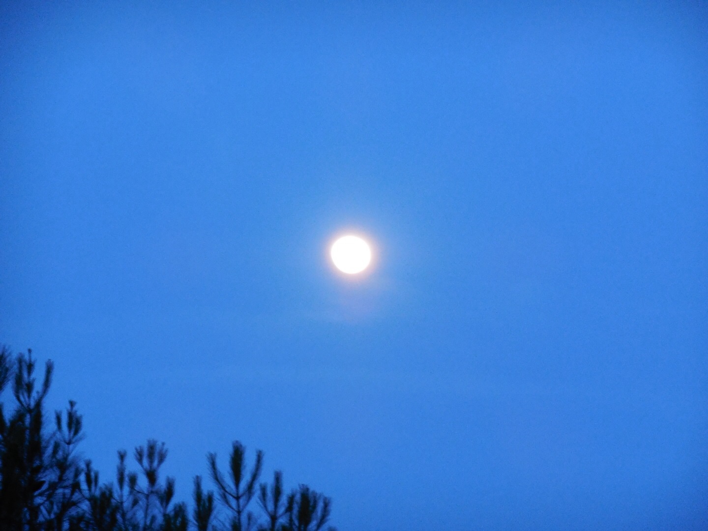
Shimmering Selene, silver sky climbing but one day before the majesty of her full regalia bids us to enter our little green and orange haven.
Day 2
A broad expanse of blue sky with only a few clouds straggling near the horizon greets us as we repack early next morning.
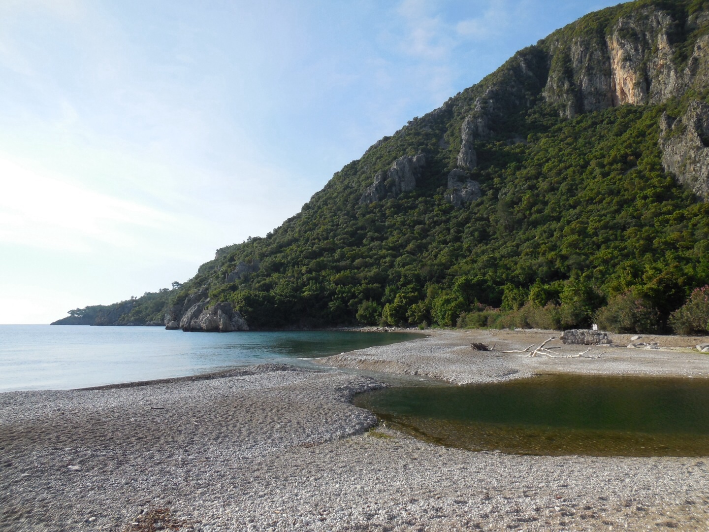
For the second day in a row we struggle along an empty pebble beach with heavy packs as an early morning heart starter.

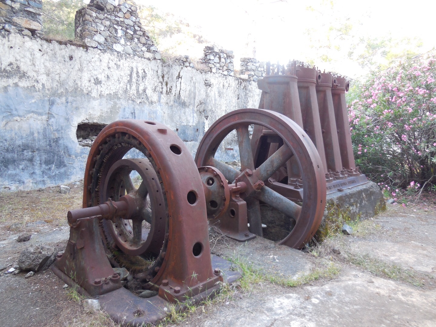
The end of this beach was once the site of a productive Chrome mine and the remains of a huge four cylinder diesel engine lie rusting within the unroofed stone walls of the old buildings.
The winding trail we follow up the hill beyond the old mine site would once have been a functional road and compared to the terrain we have become accustomed to it is very easy going.
At the top of the crest this trail joins with a recently constructed gravel road that we follow up and down for many kilometers without seeing a single marker.


This must be the ‘new road’ the Lycian Volunteers were talking about yesterday.
On mapswithme the line of this road ahead shows clear all the remaining way to Tekirova however Pam is still concerned that we are not following directions given in the guide as the trail seems to have been largely destroyed or disrupted by the roadbuilding.
The third paragraph of our guides vague descriptions begins with the words ‘From now most of the route is downhill’ which turns out to mean steeply up and down like a big sweaty slow paced plodding rollercoaster.
Despite my best efforts to keep us following the clear and easy road Pam insists on making our way towards a tiny beach where an abandoned shelter forms a little pocket of squalor at the far end.

With the guide describing a now long gone trail leading up from the end of this beach I can only see options of climbing cliffs around the headland to come or bushbashing our way back to the road winding up overhead.
The last section of this ‘Mick Special’ requires our scrambling up the very, very steep loose gravel shoulder of the road which collapses under each step.
I just make the crest before my footing gives way under me and Pam is unable to proceed. Pacerpoles come to our aid again as I reach one down for Pam to grab as I pull her stumbling uphill before we latch arms for the last couple of meters.
With her legs turned to jelly from fear and effort Pam agrees with my demands for no more Clow Specials taking us away from the road and we stride on uphill once more.
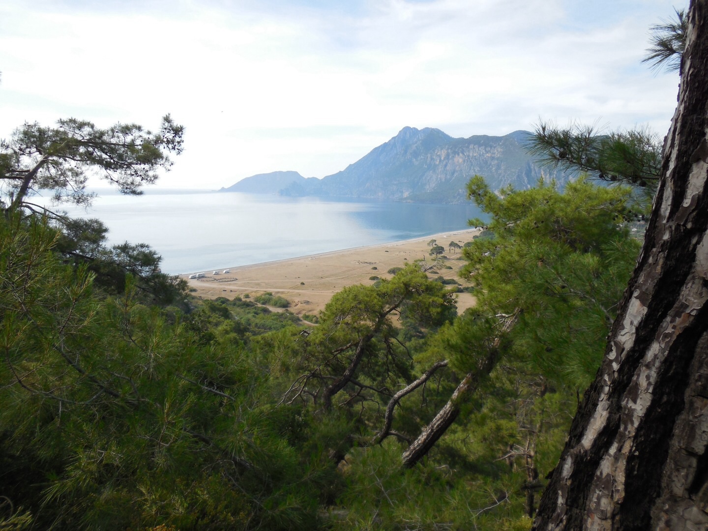
A long sweeping gravel beach with a rock formation that has us giggling at the sight of gravity defying inverted testicles at the far end means we are now beyond the midway point of our days hike and our early morning start means we have plenty of time to rest and swim.
From our high vantage point of the crest of the headland before the beach I can see rocks at the far end of the beach that look ideal for spreading out our sweat soaked clothes to dry and we push on reinvigorated by the thought of the cool blue heaven to come.

Grinding down the steep last section of this hill a highly modified four wheel drive dual cab ute scrambles upwards and gives us a friendly toot.
Following the road around the inland curve of the beach we come across a water altar/spring with a long blue plastic pipe spilling an unceasing stream onto the road.

Washing yesterdays dried sweat from the hollows of my eye sockets and filling water bottles to the brim elevates my mood even before I splash a stream of cold water across the back of my neck and down my back.
Pam is saving her head wetting for the ocean and is keen to move on once she has had a drink.
Just before we reach a little section of road that veers towards the beach we are passed by a group of day hikers with light packs. Some of them have no packs and are not even carrying water which I consider crazy however it definitely means that we don’t have that long to march.
This information makes the Siren cry of the blue Mediterranean even stronger and moments later we are pulling off our stinky boots, peeling off our sweaty stiff clothes and walking down to the waters edge wearing sandals and undies.
Cool delightful weightlessness ahhhhhhh it is bliss.
Blue water all about and azure heavens above. Sandals act as foot floats turning the Mediterranean into a gigantic water bed.
Pam is shivering by the time she gets out to dry on the rocks however I stay in the cool buoyant environment a long while longer before I join her.
My clothes are stiff as boards with sweat salt but thankfully warm and dry by the time I have to begin dressing again for the recommencement of the next uphill to come.

Up and down, up and down, definitely not mostly downhill. Eventually we find ourselves walking around the back of another pebble beach where several tourist boats are anchored to enable swimming whilst a jet ski rider shows off nearby.
Obviously we are getting close as we come to another water altar at the far end of the road that curves around behind the beach however I take the opportunity to fill my water bottles again just in case.
A German hiker who is walking shirtless passes us here and asks us if we know where we are or how far we have to go to make Tekirova however he finds my claim ‘that this is probably the last hill to climb and it all should be downhill from there’ strangely dissatisfactory.
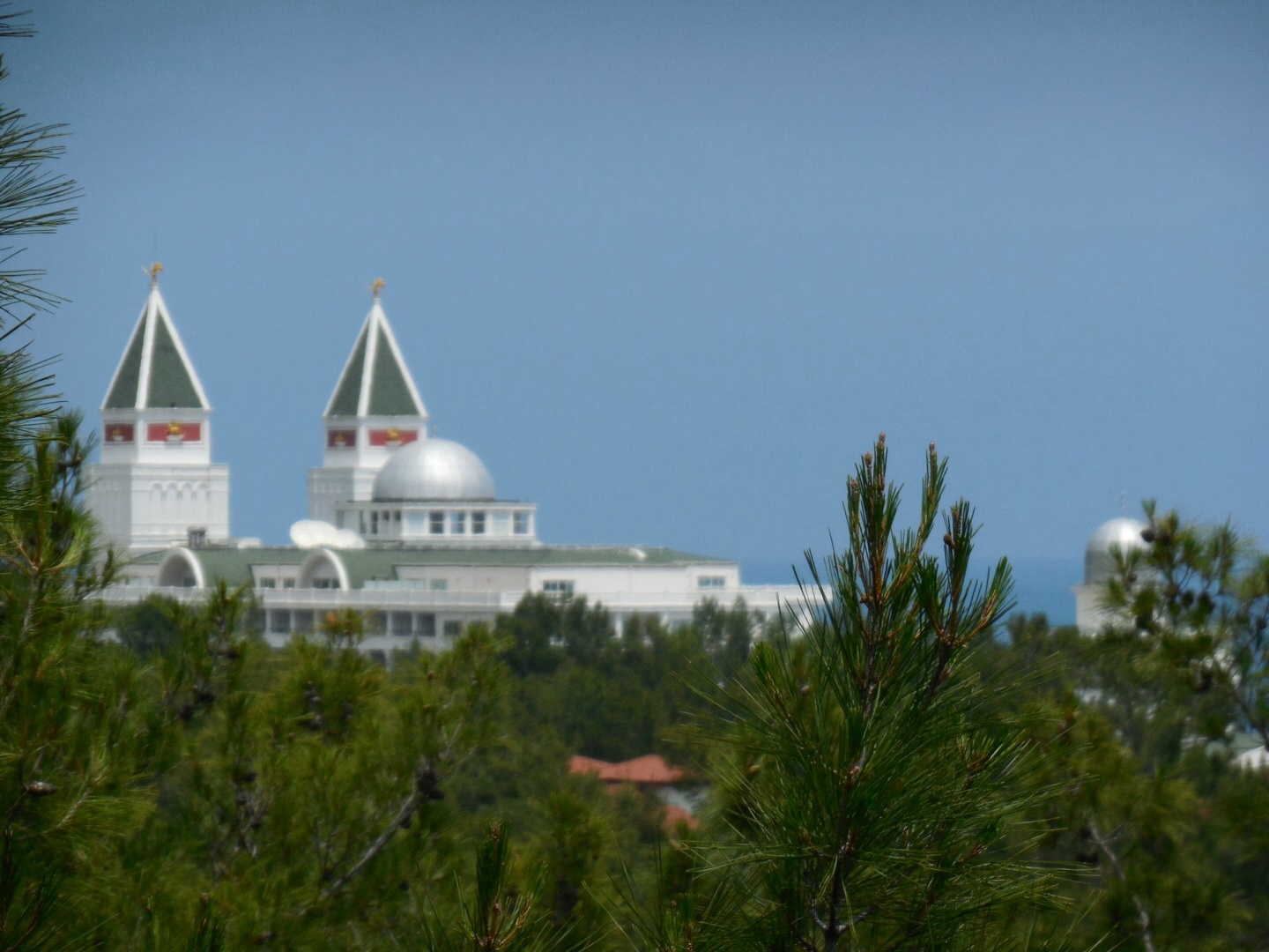
This last hill seems to climb forever however at last we are walking downhill towards a fancy hotel built above the cliffs of the headland we have walked around.
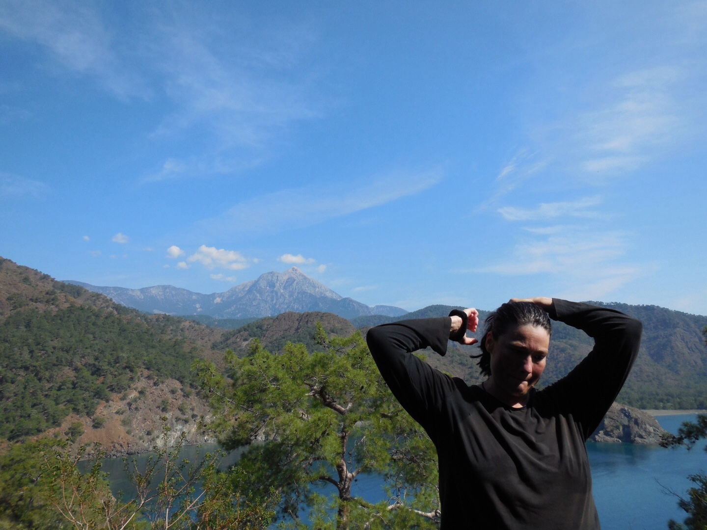
Pam is in full downhill stride now leaving me behind in her wake and I am looking at my feet when I hear a panicked cry ahead.
Slipping on the gravel Pam has gone down hard on her left knee before tumbling over on her back and by the time I reach her to assist her escape the confines of the pack straps tears are making little clean trails down the sea salt crusted on her skin.
Luckily she has not been badly injured and the tears are more from shock than pain. I do my best not to imitate the laughter Pam rewards all my tumbles with.
There are no rocks or resting spots convenient to our location so I unclip my rubber mat that is rolled around the little three legged stool I have christened ‘Sample’ so that Pam has somewhere to sit and rest.
Her knee is a little scraped and bruised and she has strained her right ankle slightly however she is such a super trooper that in a few minutes or so she is good to go and strides off ahead leaving me struggling to repack Sample and catch up with her.
A few twists and turns on the gravel meets the bitumen beside a series of luxury beachfront hotels. We struggle down the last little downhill and decide to catch a taxi into Tekirova.
Tekirova is a shop filled town that apparently exists for the sole purpose of ripping off tourists.
Prices are all displayed in Euro’s rather than Turkish Lira and we pay three times what we have ever paid for a meal in Turkey for our simple lunch then stupidly ask the cafe owner to call us a cab to take us to the Sundance Camp pension before we realise the Taxi filled cab rank is almost directly across the road.
10 Euro/30 TL is three times what we paid for the longer cab ride into town and has us suspecting collusion between driver and cafe owner however the cab driver insists on the amount despite Pam’s haggling.
As the cab pulls away she is so mad that even the large growling dogs who greet us near the entry foyer have the good sense to keep a safe distance.
Pam is still burning within from being ripped off even after a hot shower has worked its magic however a few glasses of wine in the cool comfort of the communal dining hall of the Sundance Camp eventually take the edge off and find us laughing once more.
PLL
Pam and Mick


Aww poor mama. It’s only funny when you fall Joan 🙂 Gorgeous pix as usual xxx