Lycian Way, Turkey. Bezirgan to the Magic Circle.
All through dark of night, dogs bark and howl in unending echoing concert. Seemingly a couple of them consider the surrounds of the campsite home turf and circle around our tents frequently answering other dogs calling in the valley.
Lying too long in any one position is painful in a tent. Pam and I are used to broken sleep by now as we toss and turn and neither of us find the noise prevents us from returning to our shallow slumber.
Gerard on the other hand is having a tough night.
Periodically he shouts out in a vain attempt to get the dogs to move away. Deep in the morning his efforts culminate with a roaring desperate declaration ‘if I had a gun right now I’d blow your f@#$ing heads off’.
In the morning he greets us sheepishly, ‘f@#$ing dogs, didn’t sleep a wink’. Still he finds the energy to give us a great ‘British Lad’ pose as we take his photo and promise to post it to him on our return to Australia.

We pack our tents up simultaneously and Gerard leaves ahead of us as we stop to fill our water bottles at the mosque.
Walking through the village in the early morning a man working on the foundations of a new building insists we stop and each pose for photos with him. I take one of him with the foundations after we each oblige and promise to post him the results.


Passing a mournful looking donkey tied to a fence we push on towards the village outskirts and the steep hillsides beyond.
Our guide begins the description of the section to come with the chilling words ‘This long. tough walk’ implying that what we have done so far on the Lycian Way is short and easy.
The accompanying altitude graph starts with a climb from 730m to 1000m followed by an even steeper descent back to 700m all within the first two kilometers.
A second climb back to 1000m follows with a long apparently flat section remaining after this second steep climb.
Though I am usually a big fan of walking the shortest distance between two points (walking in a straight line) I have no objection to zigzagging up steep hills.


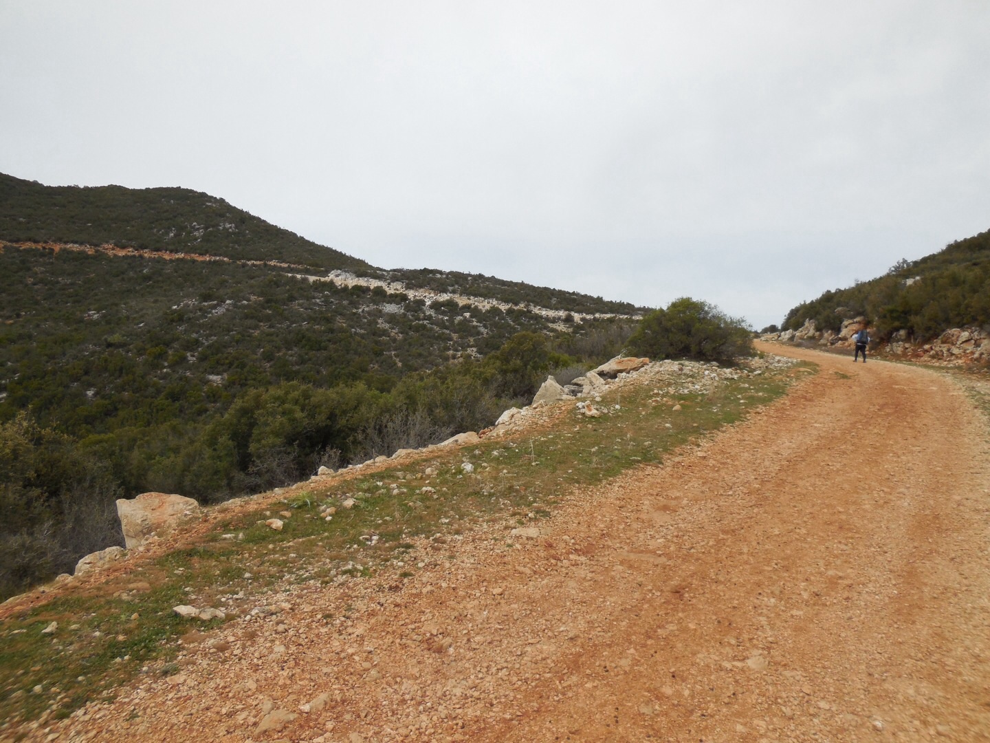
No such niceties exist on the first direct climb up the side of a watercourse. Gasping we make the scramble up the shoulder of a perfectly good gravel road that would have taken us to the same place, pass a water pumping shed and turn right towards the main bitumen road that winds down to the valley beyond.
Though we are still climbing as the gravel road turns right and circles back around the crest of the first hill heading towards yet another peak, compared to our first climb the incline feels almost flat.
Ahead I can see a rough path carving down a watercourse from the left curve in the road and I bet Pam that this will be our descent.
Pam nearly loses her footing on the steep shoulder of the road as we start heading down and it takes a while for her jelly legs to subside enough to continue.

About a quarter of the way down the hill we come to a flat section where I can see relatively easy looking paths continuing down.
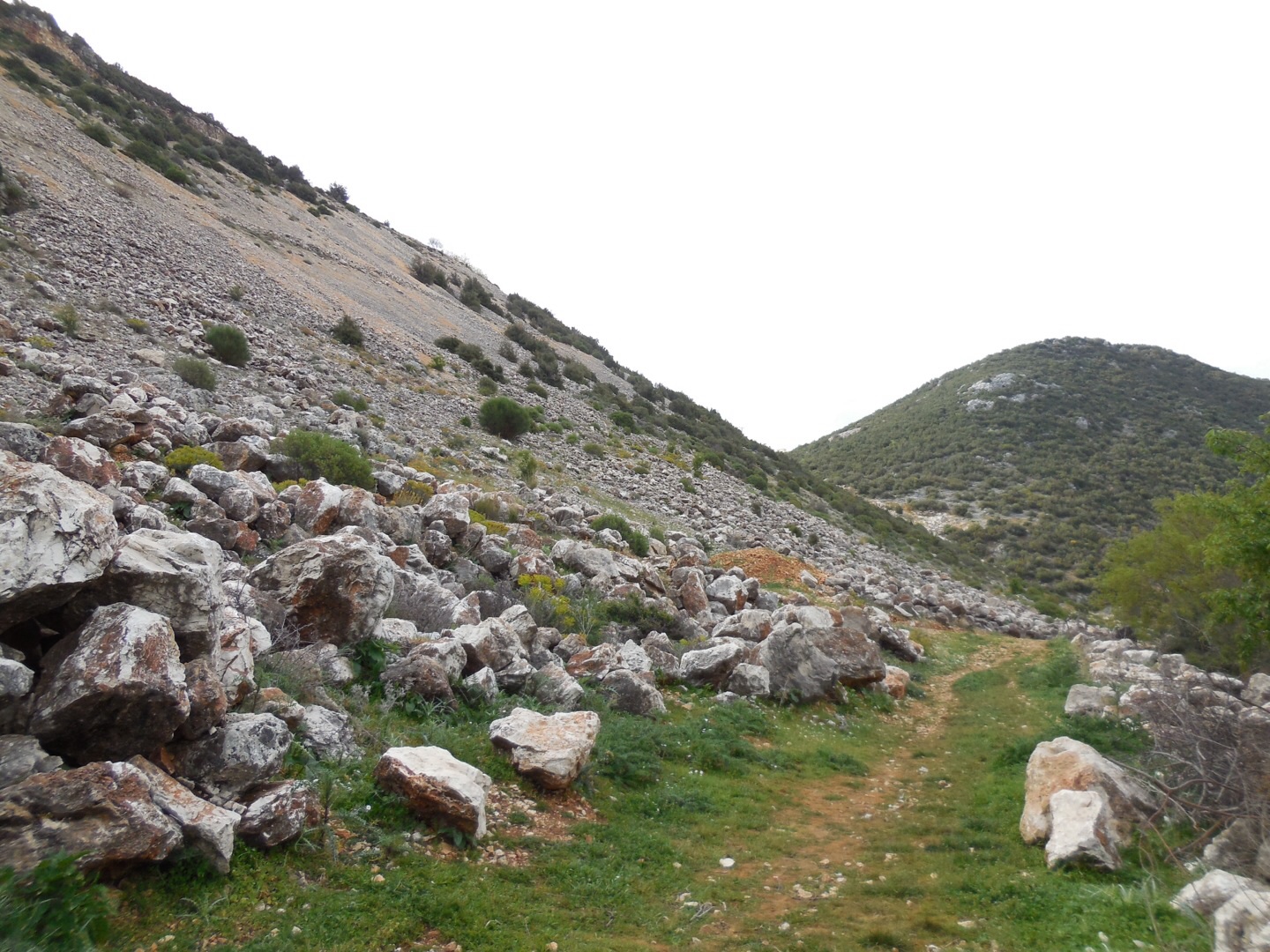
Of course ‘easy’ is not good enough for the Lycian. Instead we follow markers taking us up the slope to our left and climb the side of this gully where the terrain becomes the roughest we have traversed so far on the Lycian.
This is now genuine boulder hopping, where deep crevices lurk awaiting ankles and knees to swallow and snap. Hard enough on its own without heavy packs. Just for good measure throw in constant thorn bushes blocking the dangerous path, scratching at faces and clothes, clutching at the top of backpacks to ensure balance is lost at the worst possible moment.
Slowly, carefully, cursing our guide’s author we make our way down, down, down, section by section.
Amazingly the path leads us out beside a curve of the perfectly serviceable bitumen road where we walk for a few meters. With Pam still insisting we follow the ridiculous marked way we plunge back down the gravel shoulder heading for a tip of broken glass and plastic bottles that have been dumped from the road above.

Halfway down Pam slips and nearly loses her footing and has a case of the ‘jelly legs’ so bad she is unable to continue.
With the aid of my Pacerpoles the risk of these steep gravel sections is very much reduced and I am already at the bottom of this slippery section ready to plunge back into the boulders and thorns.
Nothing for it but to climb again and offer Pam the safety and balance of planted poles as we mince back down.
Boulders, crevices, thorns, all pass in a knee grinding descent. Finally a little flat section along the base of a cliff has us gasping in the delight of taking a few paces unfettered.
From here the rest of the descent is still steep and risky due to rolling loose gravel however compared to what we have been through so far this morning it seems easy.
Beside a few goats grazing at the bottom we rest on some discarded tractor tires lying just off the bitumen road that we could have much more swiftly and safely followed the entire way down.

It takes us quite a while to summon the will to continue, even along the flat road.
Just a few hundred meters on, the Lycian turns left off the bitumen once more and we cross a stony field where three women are tending a mixed flock of sheep and goats.

After crossing the little stream that lies at the far edge of this field we are at a loss as to where to go next however the shepherds who have also crossed the stream wave for us to continue up the next hill.
I can see a well used wide track that leads up the hill in the direction we should be following however the way markers have us following a little used goat track that we soon find is completely blocked by brambles to prevent people from attempting to circumnavigate a section that has slipped down the steep hillside.
We either go cross country here or have to descend and climb again. I make it across the rough brush under the brambles however Pam becomes stuck and one of the shepherds who have also begun to climb up the main track comes to her aid.
My frustration at finding the goat track joins this well used track just a little higher up has me cursing the ridiculous risky options we have followed so far today.
Our shepherd saviours are clearly telling Pam she should be using walking poles, rubbing their knees whilst making the universal grimace of pain. They all have wooden sticks they use to make their steep climb ahead of us with their flock easier.


Watching them forge up the hill we decide to rest again and look back over the valley we have climbed to, down, and now climb back up again.
Groaning as we pull on our our heavy packs once more we climb, climb, climb on and eventually reach a bitumen road where we turn left in front of two slowly strolling old men.
No fluency in Turkish is needed to understand them as they point out the very steep track we have just climbed and then the winding road we could have followed to the same point.
‘You are mad’ is the gist of what they are saying.
Like the two lunatics we obviously are we just keep on keeping on. The road takes us alongside a little stone walled orchard to a junction in the road where there is another water altar.
Stripping off our packs we sit on the stone wall in the shade of a tree as I cross the road to fill our depleted bottles. A friendly man tending the trees offers us some of the green bitter fruits that grow on these trees which I have called ‘Green Boys’.
I am becoming a fan of the Green Boy as they seem to add a bit of pep back into tired legs however Pam only eats them to be polite on the couple of occasions we have been given them in the past.
Despite the altitude chart showing only climbs for this section, from the junction we turn left and surrender precious meters already climbed.
The road takes us down quite a way around a few corners and at a little roadside shelter on the left of a curve we come across a group of primary school children.
Answering the multiple greetings of ‘hello’ we walk through their midst. Obviously a school class, their teacher tells us they are good students and that they are celebrating a birthday.
We offer to take a photo and in a flash the class has assembled themselves on the side of the road in order of height, with a few boys standing on a rock.

Pam calls ‘cheese’ and all of them reply in kind except one bright spark who replies in Turkish ‘peynir’.
I get a shot of the birthday boy and we promise to email the teacher with the photos.
Just across the road from where the children have posed are signs showing where the route we doggedly follow scrambles up the steep gravel shoulder before climbing the hills above.
Even school children are telling us we are mad, pointing at the slippery path and rolling their eyes.
Hoping not to have a ‘funniest home video’ moment in front of our new audience Pam and I make it to the top and disappear into the bushes following the fence line of a small graveyard.
Three distinct paths offer options from the flat clear section we soon come to, none of them bear markers however one looks much more frequently used than the other.
With the fiasco of yesterdays long fruitless early climb still fresh in my mind now we don’t climb more than fifty meters unless we see markers.
Having still not reached a marker within our new threshold we turn back and down and cast along the other two tracks only to still not find a single marker. Turning to our mostly indecipherable guide book leaves us none the wiser.
Finally we decide ‘the only way is up’ and head back up the path we have already climbed once then descended. It takes at least a couple of hundred meters before we see the first marker and then suddenly they are everywhere showing the undeviating walled path ahead.
Crunching uphill this stoney path leads to a gravel road where we turn left and climb further uphill to a bitumen road where we turn left once again.
Markers peter out once again and we are just about to turn back to try and find the last marker we have passed when a local waves us to keep following the road. A few hundred meters on another green and yellow sign advises us to turn right off the road and climb yet another goat track.
Pausing for rest in a rock wall terraced agricultural area finds us wondering where we are in the guide and how much longer we have to climb and walk to reach our destination. Despite our efforts so far, the sign we have just passed says our destination is still another thirteen kilometers away whereas the guide book says the entire day is thirteen kilometers.


Apparently we are standing still though it sure doesn’t feel like it according to my legs and feet.
Either the guidebook or the Lycian sign is being loose with the truth. My confidence in the information contained in the guide dwindles with each read.
Guess there is nothing for it but to climb on regardless.
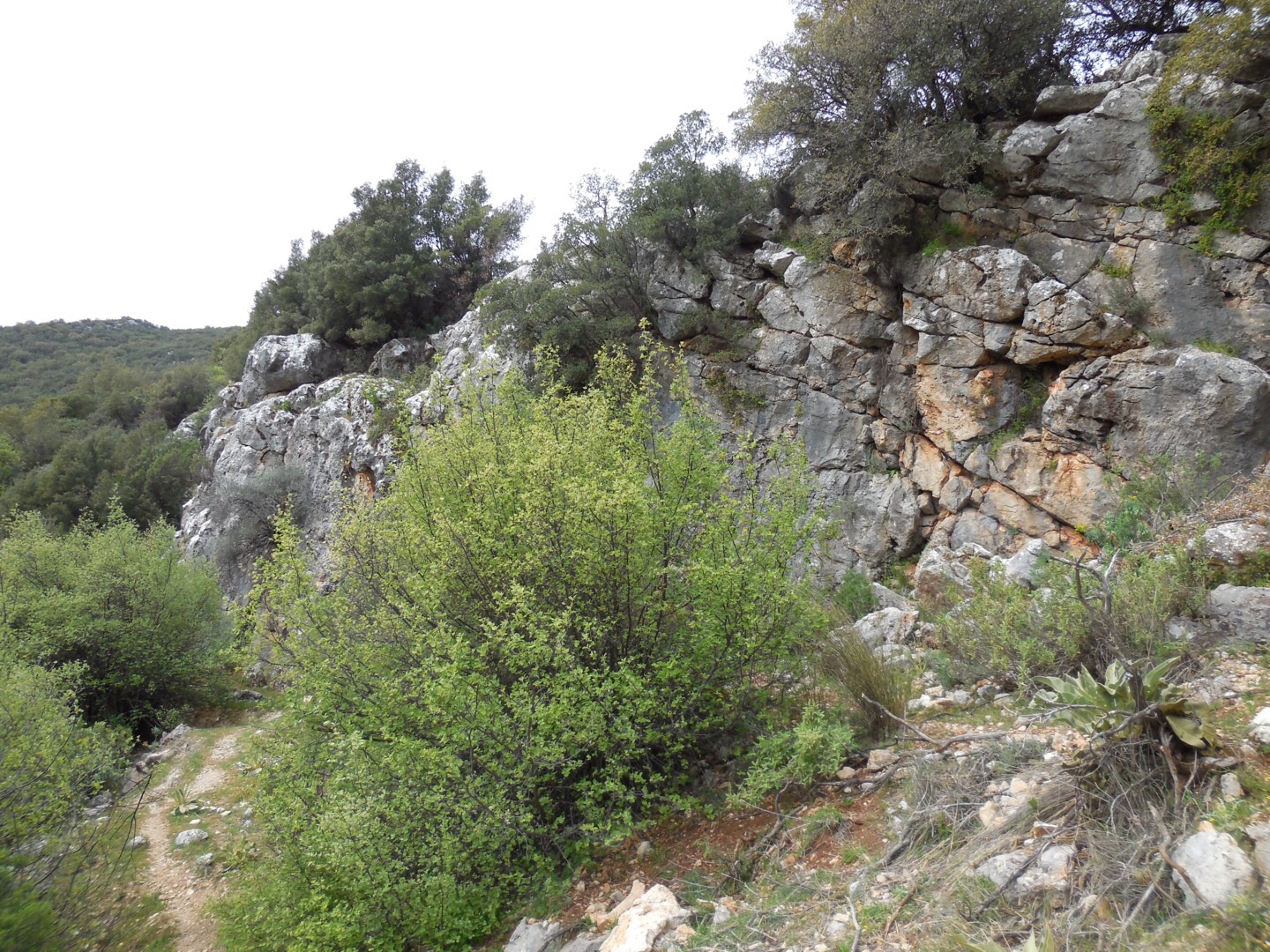
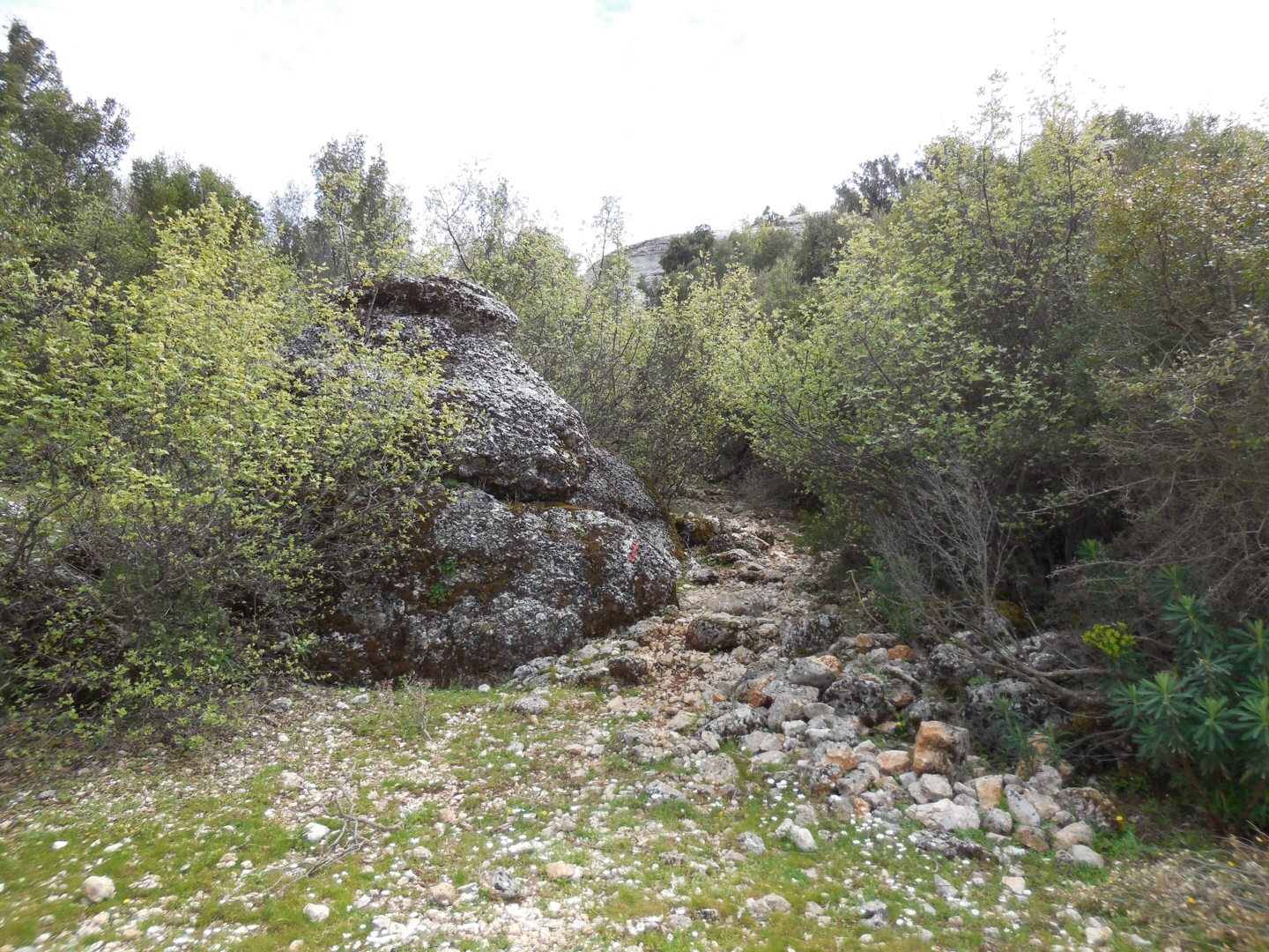
Onwards and ever upwards, we rest again in a clearing that lies just before the way enters between spectacular rock structures.
Pam lies down again here as I wander around taking photos of the rocks and views down the valley where we have climbed. I can see we have almost drawn level with our climb from this morning so hopefully we don’t have that far upwards left.
Maybe it is the embrace of the ageless weathered stones wrapping around us, or the shade cast by the tall tree’s boughs. A palpable air of serenity lifts my spirits and despite my frustration with our guidebook and the rough terrain of the morning section I find myself suddenly at peace.


It’s all good.
I return to find Pam is almost asleep on the ground, it takes a while to get her up and about again.
Crossing the clearing towards the rocks I notice some pink plastic that looks a little like a plastic false tooth plate embedded in the ground.
‘Surely not’, I move the plastic with my Pacerpole and sure enough a little row of white chompers shine up at me.

Now the Lycian Way has a grinning marker atop a stone to show the path ahead.
Our path weaves between the massive grey stone protrusions of the landscape and we finally crest the last slope for the day.
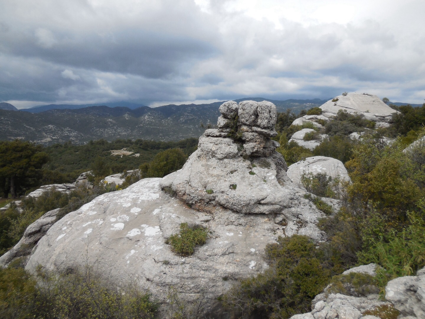
New horizons of stone and bush await across the valley beyond. Our path is once more rough and stony however compared to our morning efforts everything now seems easy.
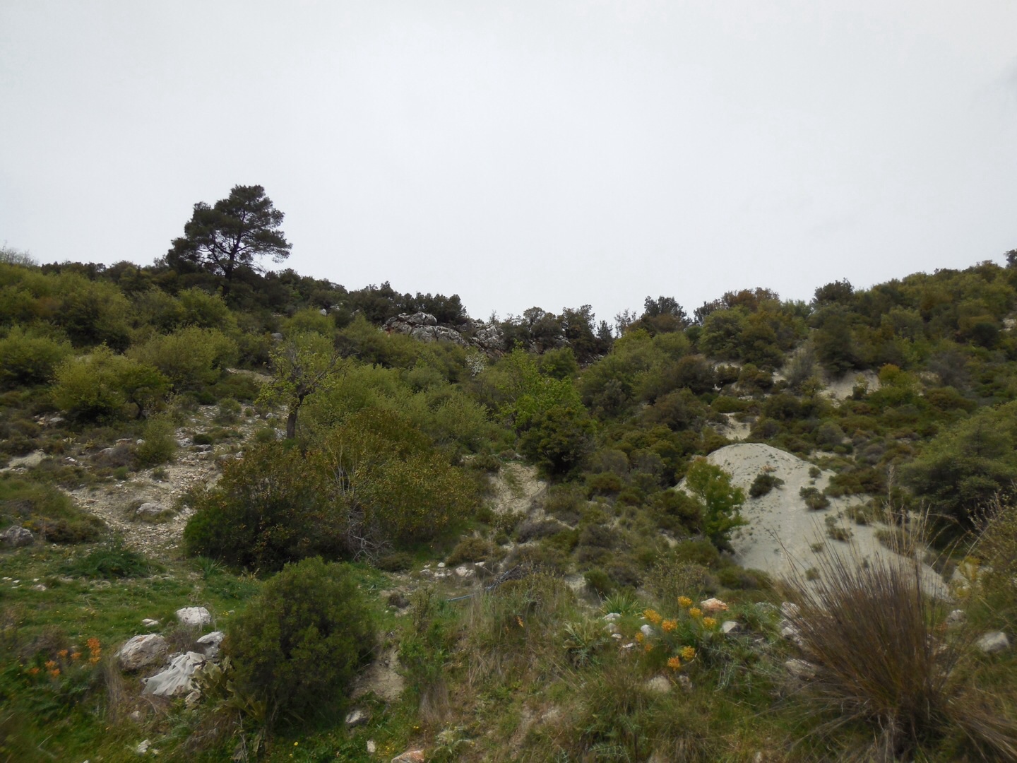
Three quarters of the way down the hillside I see a stone charcoal maker’s circle at the bottom of the valley.


A magic inviting white stone ring circling a smooth bright green centre. It looks a perfect place to pitch a tent.
‘Shall we camp there’? I ask Pam. ‘Lets see how we feel at the bottom’ she replies.
The moment we pierce the circle of the stone ring Pam gets her rubber mat out and collapses onto the buoyant green grass.
‘I’m done’.
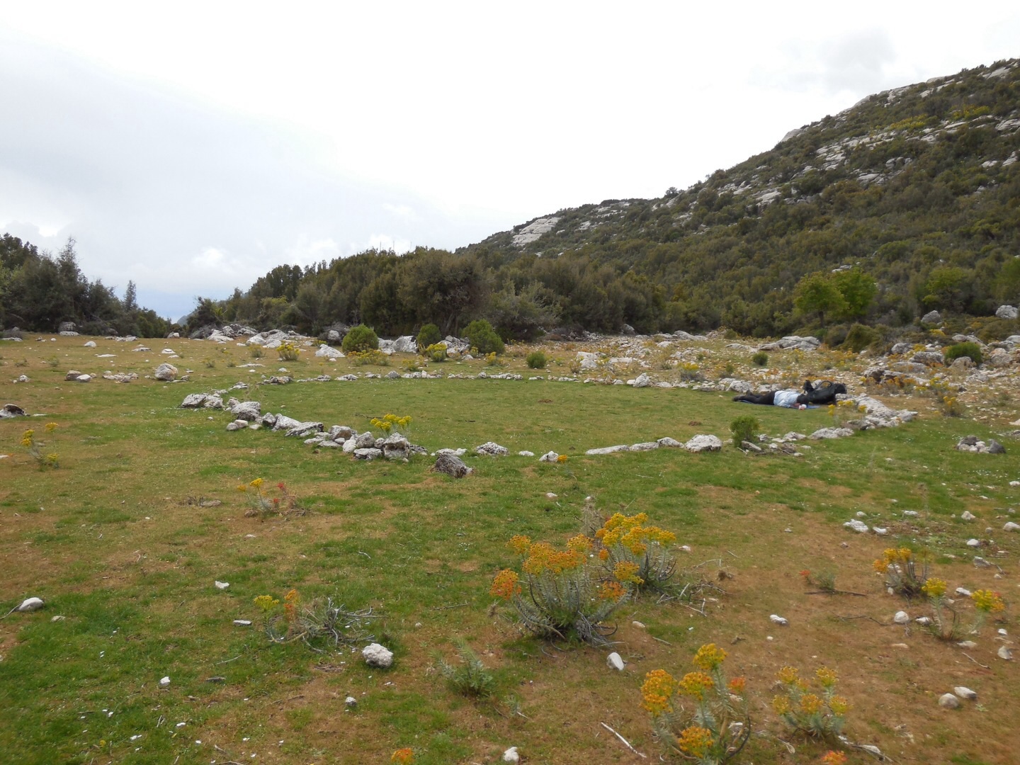
According to Carlos Castaneda such a response in such a place would indicate this is an intersection of energetic streams coursing throughout the Earth, a Power Place.
Four litres of water remaining gives us the freedom to stay the night anywhere and a better camping spot I am yet to see on the way.
Grey clouds have gathered in the afternoon and we quickly pitch the tent just to be sure. Gear stowed, Pam lies down inside, there will be no moving her further.
I take many photos of the beautiful surrounds as the grey above thickens.


Drops falling wide spaced from above send me scurrying for our green and orange haven.
5:30pm I pull the zippers closed and we write our notes for the day.
Both of us beat the sun in sleeping.
PLL
Pam and Mick


On the edge of my seat reading the last 2 blogs, hoping you found water and no broken bodies on the way. Take care love Anna
Thanks Anna , we are ok .. as you can see , I am resting plenty haha. Pam x
Nice ass!
Haha … oh bevis 🙂